![]()

![]()
|
        |
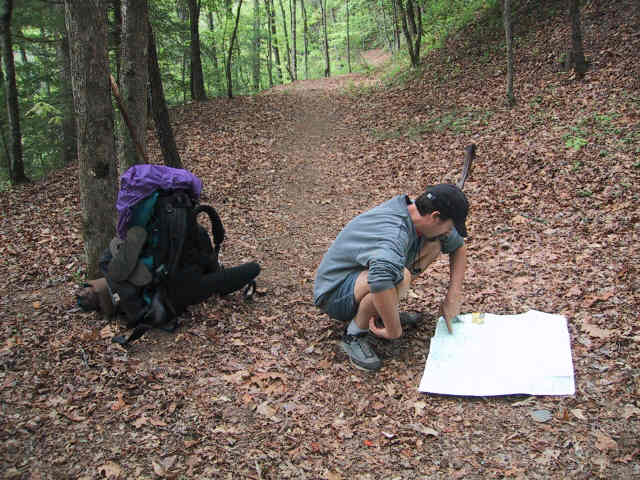
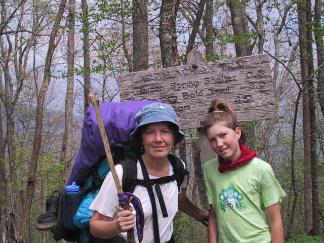
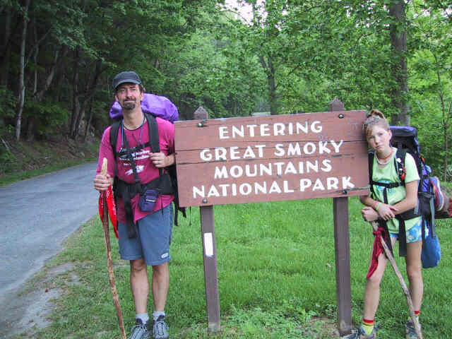
The first order of business was to establish our route of travel back out, as this was to be our last day in the backcountry. We had enough food for another full day if necessary, and indeed we had thought we would stay one more day at Eagle Creek, but the rain the prior day had spooked us, so we packed up in preparation for the 6.8 mile walk out. Below I am puzzling over the topo map, as the trail signs and the map did not line up properly. After some discussion, Jody and I talked Jordan into some additional mileage so that we could hike up a side trail to the Appalachian Trail (AT), and then take the AT south to Fontana Dam, near our destination back at the marina where we had taken the boat shuttle. We started off in what looked like the right direction, following the path you seen in the picture below. This turned out to be a dangerous, unmarked trail to the lake. We turned back and decided to skip the AT section, only to find the proper trail markers a half mile from the first set. So, we again set off, this time confident that we were headed on the right trail -- the Lost Cove trail. By examining the topo it was clear that this hike followed a small brook for a mile or so, and then headed straight across the gridlines of the topo, which means it goes right up the mountain. Looking at the numbers, it was over 2400 feet of elevation gain in 2 miles. Jody said she was up for it, so up we went, with Jordan saying she was game but worried about it.
Well, it just about killed us. It took us over 2 hours to climb those 2 miles to the AT, and when we got there we were exhausted, with miles of trail to go. Jody speaking here: I am estimating the angle of climb at somewhere between 35 and 45 degrees. We were only following horse tracks and I definitely felt like a pack mule. At one point, I am ashamed to say, I broke down in tears and really felt like I would have to leave my backpack in order to make the climb. The thing about climbing mountains is that it is always deceptive. It is impossible to see the summit and every time you think the top is at the next rise, there is more mountain. Climbing up this steeply served to make our calves unbelievably sore for the next 3 or 4 days. Doug told me later he thought my pack weighed about 40 to 45 pounds, which had I known I would definitely have thrown stuff over the side. Prior to getting to the top, we lunched on our apples and granola bars, which helped to restore us a bit. Below, you can see how excited Jordan was to be on the AT.
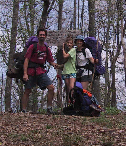
I again used the camera timer to capture the image below. We look deceptively like real hikers, don't we?
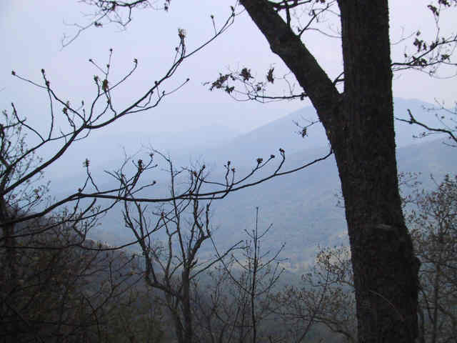
This was one of the views we had once at the top. For the most part, the AT runs along the highest ridges in the Smokes, affording breath-taking views. You can readily see from the picture why these are called the Smokies.
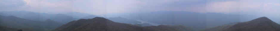
Once at the summit of this segment of the trail, we found a small side trail that went up to a fire lookout tower. We left our packs on the AT and walked up (even voluntarily). This was not Jody's cup of tea, but Jordan and I climbed the ladder to the top, and I took the 8-frame composite panorama shot below. This covers about 300 degrees of view from the tower. The image you are looking at is one tenth size of the original.
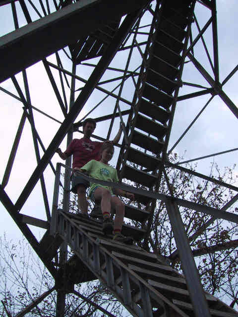
Here we are descending from the tower.
As we neared the Fontana Dam, at about the 8 mile mark for the day, we encountered this sign greeting AT hikers headed North. We thought that at this point we had less than a mile to go. Wrong.
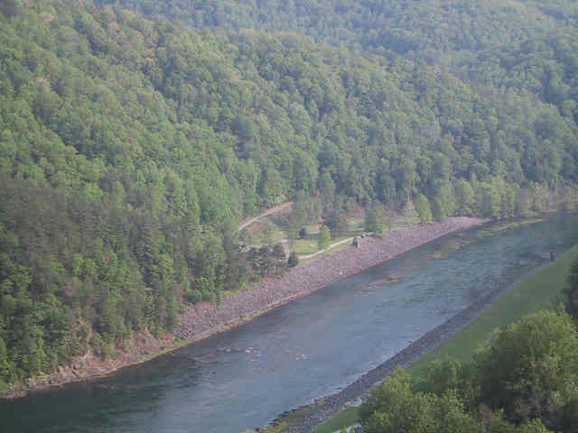
We walked across the Fontana Dam, and looked down upon the campground which we had stayed at in Fontana Village 4 nights before, and where we would camp that night. Fontana Dam is pretty damn high, indeed (sorry, I could not resist).
Shortly past the dam on the AT was the fabled "Fontana Hilton", the nicest of the AT trail shelters. We wanted to see what one looked like, after reading so much about them in the Bryson book, so we stopped by, gave it a look over, and chatted with its sole occupant, a man who was southbound section-hiking the AT. We heard from him that he had recently crossed a family of 7 who were thru-hiking the AT. Thru-hiking means that they are walking the entire 2100+ miles of the AT, from Georgia to Maine, in one long hike (reprovisioned about weekly, of course). This was astonishing to us. Jody and I had talked about thru-hiking the AT one day, without the girls, since it usually takes about 4 months. The logistics of handling a hike of that size for 7 people was daunting. The man further told us that they were lugging a single 7-person tent along with them. Our 3 or 4 person tent weights nearly 9 pounds, an amount I had qualms about at the time of purchase. I cannot image how much theirs much weigh, although they almost certainly split up the weight amongst themselves while hiking. Our trail guidebook was a bit vague about the last leg of our trip, from the Fontana Dam to the marina. We assumed we had some small number of yards to go. The book said to follow the AT until it crossed a road leading to the marina. It turned out to be over a mile, with six or more small hills to traverse thrown in for good measure. It was nearly full dark when we emerged from the woods within a matter of feet of where we had parked the rig at the marina; the AT went right through the marina in fact, and we had failed to notice that fact when we departed. The days total mileage was over 10, in full pack; more than 7 hours of straight walking with 50 pounds on our backs. As soon as we got to the trailer, it began to rain. Amazing timing. We quickly stowed our gear, drank a celebratory virgin pina colada, and drove off to find our campsite. That nights dinner was a simple pasta, with a huge green salad, and several very cold beers. May 3 - To Harmony
|