![]()
![]()
|
        |
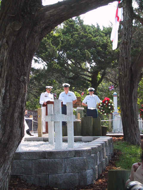
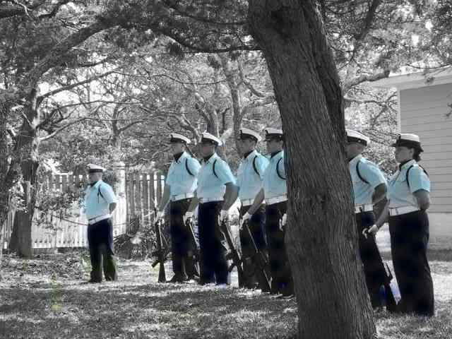
This was departure day, so we spent the first part of the morning packing up. Teeter's was adjacent to the "British Cemetery", which had an interesting history. It seems that during the second world war, German U-boats were actively hunting ships in the Atlantic off the coast of Ocracoke. On May 11, 1942, a British war ship was hit, and sunk almost immediately. 4 bodies washed ashore on Ocracoke, and were buried there. In order for the men to be buried on British soil, this small parcel of land was ceded to Britain. Each year on this day, a military ceremony takes place to honor these men. We observed this brief ceremony, and Joya photographed it.
In case you are wondering, the photo below has been processed by Joya.
Our route for the return trip was North, up Cape Hatteras, to Kitty Hawk, and then directly West (again) across North Carolina, back to Raleigh/Durham. Quite a distance, but we wanted to go slow with lots of stops so as to enjoy the outer banks as much as possible. As we were rejoining a main highway, we spotted a turtle gamely attempting to cross the road in front of us. We stopped and Jody, being a charter member of Rescue The Turtles, leapt from the van and assisted the turtle in his task. He seemed quite grateful, and continued on his course once safely on the other side of the road.
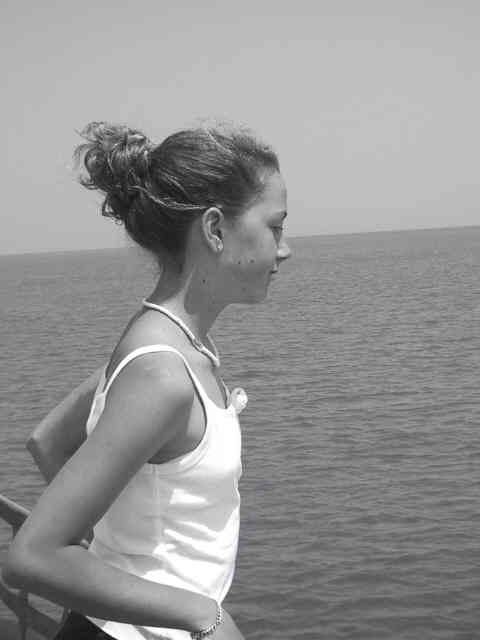
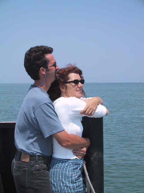
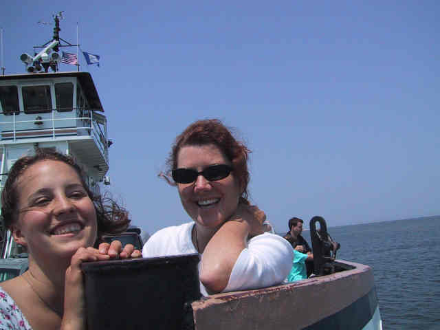
Once we got to the northern end of Ocracoke, we again had to board a ferry, this time for a much shorter trip of 40 minutes, to Hatteras. The images that follow were taken while aboard the ferry. The day was lovely and warm, with mild seas, so this crossing was much gentler and less anxious that the prior one.
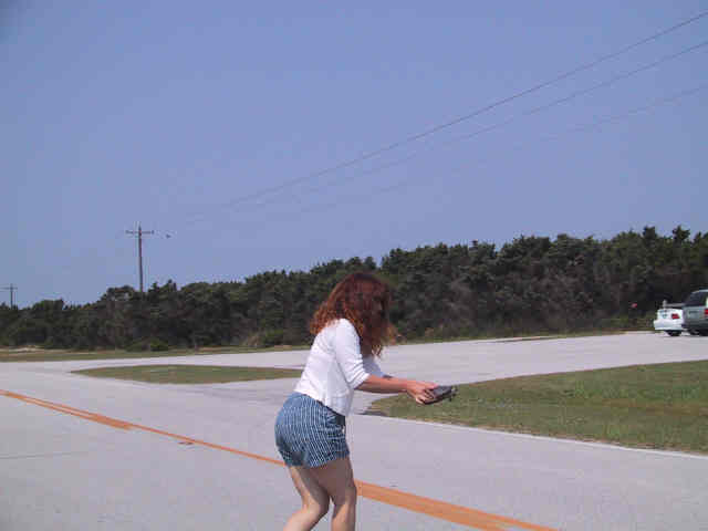
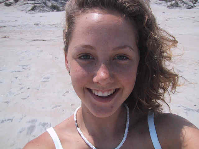
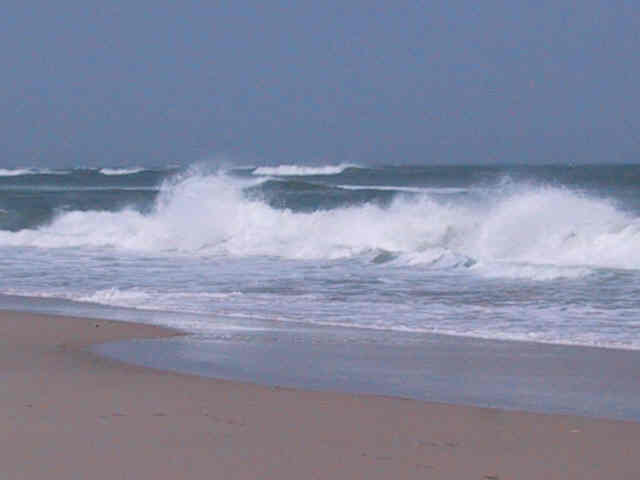
Once across, we began the long slow drive northward up Hatteras, through the various small villiages that dot US 12 along the way. We did not like any of them nearly as much as Ocracoke. After we had been driving for an hour or two, we needed a break, and the beach was calling to us, so we stopped at a rest stop and crossed the highway to the Atlantic beach side. It was utterly deserted, warm, with continuously thundering breakers forming a visual and auditory background. Below, Joya takes her self-portrait.
The waves were beautiful and chaotic, with lines of breakers going back six or seven deep.
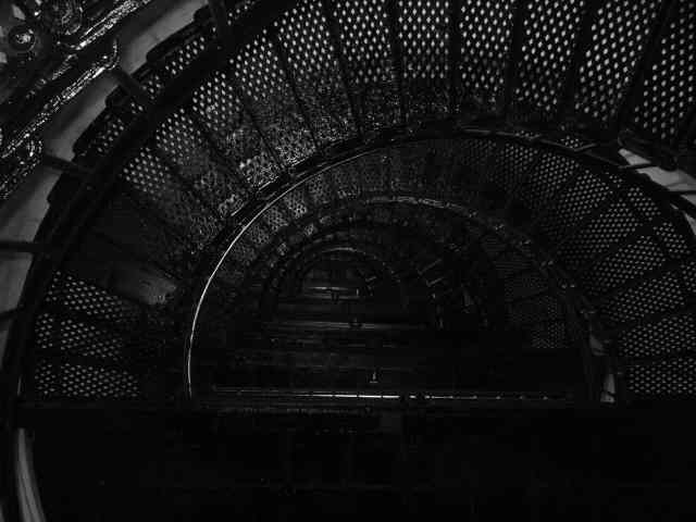
After the beach, we loaded up again and continued our wandering drive. We spotted the Bodie Island Lighthouse, and went over to have a look. I stayed in the car, not being terribly enamored with lighthouses, but someone in our little party took the facinating image below, which is of the interior metal stairs within the lighthouse.
We again loaded back up and continued our maunders, eventually arriving at Kitty Hawk. The Wright brothers chose this vicinity because it is nearly always windy there, and it did not disappoint in that regard, blowing very steadily but not unpleasantly hard. The small museum at Kitty Hawk contains a reproduction of the first airplane, and very little else, so we did not stay long. Across the parking lot from the museum is Kill Devil Hill, the actual hill used by Wilbur and Orville during their tests and eventual success (which was 12 seconds of actual flight). Next we backtracked a bit, and then headed West, for four straight hours. The driving was pretty easy, and very pretty for the most part, passing as it did through many farms and woods. We were trying to beat the clock, in that our chosen campground closed its gates at 9:00 PM. As it turned out, we pulled in at 8:30, and quickly set up camp and prepared a late dinner. We were back in Falls Lake, and the next day we were to put Tessany onto an airplane for the next leg of her journey: to visit with her sister Mylie in Austin, and with her mother Lanis who happened to be visiting with Mylie at that time. |