![]()

![]()
|
        |
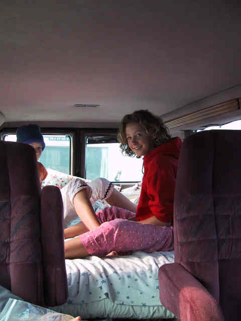
Jody and I got up early (at about 7:30) and got us packed up. We let the girls all sleep in. When we were all hitched up, we had them move into the bed in the van for more sleep. We got away at 9:00 AM, right on schedule, and headed Southeast for the Outer banks, 250 miles away. Jordan had baked breakfast the day before, so we all feasted on Maple Spice cake, coffee, and tea. The driving went fast, and before we knew it we were at the ferry station at Cedar Island. The ferry ride was to take 2 1/4 hours. We got there in time for the 3:00 PM ferry, although it had rained hard on us for the last 30 minutes of the drive. We boarded the ferry without incident, although it was a close thing. I was driving, and was on the phone with United, trying to straighten out the duplicate charge we incurred for Joya's plane ticket, and simultaneously trying to follow the directions of the ferryman who was directing me how to get my 43 foot rig safely on board. Finally he got right in the windshield and yelled PUT THAT THING DOWN. I handed the phone to Jody, and then accurately followed his instructions, successfully installing us toward the front of the boat. This was a huge ferry, capable of carrying perhaps 50 or more cars across the Pamlico Sound for the crossing. The winds were expected to reach 60 miles per hour, and seemed to hit that mark nicely and then some. Below, Tessany is blown about in the wind. 
We were strongly encouraged to just hunker down and stay put during the crossing, since the weather was so bad -- in addition to high winds, we also had a pretty decent swell. So, for the most part we remained in the van, as below.
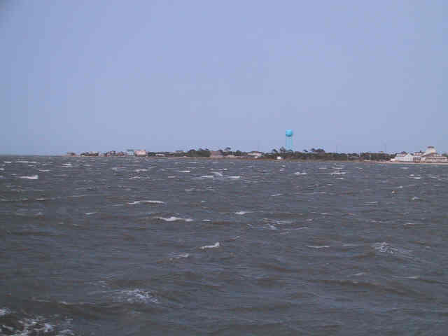
We reached the other side about 20 minutes late, due to the foul weather. Here is our first glimpse of Ocracoke Village -- not much to look at from this perspective, but you can see that the seas look pretty rough. Remember, we were crossing Pamlico Sound, not the part of the Altantic.
We had made a campground reservation at "The Beachcomber Campground", but after inspecting it we found it to be rather dreary and treeless, so we continued on to check out the other 2 places to camp: the State Park, and "Teeter's". The State Park was in a beautiful setting, but it was too austere and primitive. No hook-ups of any type, and only cold showers. In addition, even though they had 12 miles of beach to use (almost all of Ocracoke Island belongs to the State Park service), they had packed the camp spaces in very closely, with no trees in between. So we drove on to "Teeter's", which was right in the village. It was funky, but we found a nice uncrowded spot under trees, so after some discussion amongst our little group, Teeter's it was. We set up, and went on a little walking tour of the village. It was charming. There are no billboards or even stoplights. No car dealerships. Not even a Laundromat, which we found disconcerting since we were all badly in need of one. Most of the businesses catered to the significant numbers of tourists who passed through each summer, so there were plenty of small hotels, good restaurants, and beach-themed gift shops, although even the latter were somehow inoffensive. We immediately fell back in love with this little corner of our country. The entire island is only 13 miles long, and mostly less than 1 mile wide. It is essentially a giant sandbar that sprouted grasses and trees -- as is the case with the entirety of Cape Hatteras to the North, to which Ocracoke most likely was once attached, down to Portsmouth Island to the South. Look at a map of Southeastern North Carolina to get a proper feel for all of this. |